Ari!出發南迴!南田

第一次聽到「南田」這個地名,是接到劉維公的電話,邀請我們參加「出發南迴」計畫。那一天我們正好在屏東開車回台東, 打開Google Map 看地圖,怎麼路過那麼多次都不曉得有南田這個地方?

從達仁鄉的台9線轉進去,是一條沿海的公路,經過一個小社區,從柏油路到泥土路到只有四輪驅動車才開得進去的石頭路。已經開到路的盡頭,前方就是阿朗壹古道的入口。

南田不是每個人會喜歡的地方,但喜歡的人會很喜歡。在荒無人烟的海邊有一個正在釣魚的先生,朱平問他為何而來?他回答:「我想找一個無人的地方待著。」一個人特地從台東縱谷來到南田,目的是尋找孤獨。

很多時候,我們不太有機會獨處,工作、生活總是接觸許多人,周遭的雜音多了,自己的聲音也就小了。南田的海邊,孤寂而荒蕪,最適合需要跟自己獨處的人。多數人害怕跟自己相處,然而,與自己相處是一件很重要的事,當我們認識自己,就能更坦然自在的做自己。

在南田的海邊,漫天蜻蜓飛舞,這些蜻蜓像是漂浮在藝術家游文富的竹編作品「南方向量」之上。這大型作品好像邀請我們跟它互動,在裡面的空間移動,才會感受到創作的本質。

南田是台東境內最南端的部落,也是台九線公路的終點,小鎮裡沒有便利商店,人煙罕至。這次到南迴的旅程,原本預計拜訪南田的石雕師傅,但師傅卻因故無法赴約,我們決定到村裡繞繞。

秋天是原住民的小米豐收祭,和漢人農民曆裡的豐收時節相同。同一片土地上,不同族群間,主要穀物的生養作息卻是相同的。在南田村裡,同樣不只存在一個民族,除了排灣族之外,漢人客家人也居於其中,村落雖小,卻安處不同族群的居民。

南田村是個移居部落,因此有三位頭目,其中入口處是大頭目的家,牆上由部落藝術家畫上大幅壁畫。村落比鄰而居,短短幾步路,60歲的玉秀阿姨正坐在院子裡乘涼,一旁還擺了幾顆火龍果,見到我們,阿姨溫暖地打招呼:「這個火龍果我剛從山上摘下來的,這個沒灑農藥,所以有點醜醜的,但是很好吃,你們一人一顆,不要客氣,我種的東西都可以跟大家分享。」

不久後又有一個打扮入時的年輕阿姨來串門子,加入我們的話題,她喝了點小米酒,話也多了,玉秀阿姨的院子像是部落的客廳,不時有村民來聊天。過了一會,一位男子走進院子,拉著阿姨準備要走,嘴裡還喃喃:「妳不要亂說話啦。」阿姨無辜地說:「我沒有呀,他們在採訪我耶!」

天空開始下起毛毛細雨,男子熱情地想帶著我們認識南田的海。旅途中就是喜歡這樣的偶遇及巧遇。男子名叫李世明,曾經在大陸工作25年,有排灣族和漢人的血統,現在回到南田開民宿,為部落盡份心力。他每週二、五會沿著小徑到阿朗壹古道巡山,沿途經過南田石的海灘,便會靜下心看海。南田石每塊紋路都不同,李世明邀請大家一起堆南田石,我和朱平各自成塔,都堆了八塊,李世明晃悠過來,在朱平的塔上隨意一放,卻平衡了這座塔,簡直是神來之筆。

表面上是堆石頭,實則是讓我們專注在當下,讓心靈獲得平靜。當身邊只剩下一望無際的海,在海浪拍打下,能聽見石頭沉穩的聲音,是海在說話。此時此刻,我們開始聽見自己的聲音。打開五感,用心去感受身邊的事物。眼睛所見反射天空光影的海面,手觸摸風的紋路,光腳感覺冰涼而堅硬的南田石,鼻子聞到海水鹹鹹的味道。

當浪潮打來,石頭發出沉穩的聲音,也就是居民常說的「南田石在歌唱」。南田石是山上的石頭經由溪流沖刷下來,經過洋流不斷地翻滾、琢磨,造成每個石頭都圓潤而無稜角,而原本嵌在石頭內的石英結晶也因此外顯,讓石頭表面呈現出不規則的紋路,是石頭收藏者的愛好。

南田海岸親水公園 Nantian Coast Water Park(露營地)

人文景觀自行車道是一條非常陡的路,應該是從另一端上來,這裡下山,從這裡騎出去就能夠接台九線。

Ari!出發南迴!大鳥

Ari(讀音阿累)是排灣族語走吧!的意思。

南迴, 一個多數台灣人記憶中既陌生又遙遠的一隅。

探訪南迴的這幾天,正巧遇上西南氣流,台灣南方有一團雲始終不散去。南迴公路雲霧繚繞,看不到藍藍的海,天空蒼白,雨一直下,沒有陽光。

朱平開著車,我坐在副駕駛座,放了加拿大民謠歌手Leonard Cohen的音樂。滄桑的嗓音唱著我們最喜歡的Anthem

There is a crack in everything. 萬物都有裂縫

That’s how the light gets in. 那是光照進來的契機

如同這趟南迴的旅行,你無法說這是完美的旅程,但正因如此,南迴的真實與樸實的生命力,才映照出了它的美。

南迴,是一段連台東居民都未必熟悉的地方,因為人煙罕至,所以有好多神秘的故事還藏在這,獵人追蹤師、部落奇女子、排灣族巫師的話、靦腆的植物雕塑家、凌晨時分補著魚的網、荒蕪盡頭的海。南迴處處有詩,安靜地存在著許多純粹的事物。

南迴像是一座有機的森林,沒有刻意的鑿痕,人事物都保持著原始的樣貌。我喜歡這樣的旅遊(Off the beaten track),一種探索及深度的旅行,能深入地方,看見當地人真實的生活。

第一站:大鳥

台東大鳥有個笆札筏布工坊,由部落媽媽所組成,我們來拜訪負責工坊營運的經理王曉彤她希望布工坊能成為部落中心,自給自足。這裏沒有所謂的盈餘,多出來的是給小學、運動會、社區發展用的。

王曉彤做了一件事,讓全校大鳥國小的小孩都背媽媽設計的書包。每一個小朋友的書包上,都有自己媽媽袖的十字繡,小朋友看身邊的人都有了,也會催促自己的媽媽,久而久之,所有大鳥國小的小朋友,都有了來自工坊的包包,建立大家對工坊的認同感。工坊常常都有人在,小孩放學後可以來這找媽媽,寫寫功課。老人家可以教刺繡讓文化傳承下去。媽媽在部落有工作做,拿得出早餐錢,很有成就感。布工坊做出來的包包未必是我喜歡的美感,但它的價值不是產品的銷量和市場,而是成為部落的心臟,聯繫老中青三代。這就是社會企業,真正解決部落生活的問題。

南迴都是山區,即使有 Google Map 也很容易迷路

我們早到,約見的人還沒到,就自己先逛逛。大鳥部落就兩條道路,兩邊都是矮房子,最高兩層樓。這一家最吸睛,外面有隻三條腿的黃狗。主人就是圖中左邊的女士。後來才知道我們要見的人就是她,王曉彤。
大鳥街景,四處都是色彩繽紛的壁畫。
大鳥街景,色彩繽紛的壁畫。是山豬嗎?

大鳥街景,這一條是彩繪街道,難怪到處都有彩繪。
色彩繽紛的街景。
大鳥街景。
布工坊,也是部落的中心。阿嬤們有機會傳承織繡手藝,媽媽們在這裡工作,自己賺錢又有成就感。孩子們下課後家裡沒人過來這裡肯定有人會照顧。
布工坊外面的一架縫衣機,戶外工作涼快視野又寬廣。

排灣族的圖騰與色彩。
布工坊部落的經理,部落熱血媽媽王曉彤。

大鳥部落有兩家名宿。沒機會進去,不曉得裡面的裝潢如何。外面看來挺有味道的。
大鳥部落有兩家名宿。沒機會進去,不曉得裡面的裝潢如何。這家外面有個菜園。

部落唯一的餐廳。

Laksa Kelantan

Laksa Kelantan (Kelate in Kelantanese Malay pronunciation)

Most people have heard of laksa like Singapore laksa. There are so many variety of laksa in Southeast Asia. I believe what makes laksa a laksa is the fish based gravy, like the Kanom Jeen of Thailand and Penang laksa with tamarind.

Kelantanese laksa is a dish I grew up with. Rice-based spaghetti with lots of raw vegetables like snake beans, bean sprout, cucumber, daun kesom (Vietnamese coriander) and torch ginger, drowned in fish and coconut gravy. I love the taste of chopped raw vegetable but it is an acquired taste for those who are not used to it, especially when it is served at room temperature.

This is a proper home-cook version, with chopped torch ginger (the red stuff) and lemon grass. The gravy is made from fish meat which is boiled, pureed, and later mixed with coconut milk. My friend serves both laksa (spaghetti-liked rice noodles) and laksam (rolled up rice sheets).

吉蘭丹食物的特色是香草和蔬菜。我們喜歡生吃蔬菜。Laksa的配料是黃瓜,豆芽,長豆,叻沙葉(Daun Kesum),薑花和檸檬香茅。湯底用鯖魚肉、黑胡椒等各種香料熬煮,最後加入椰漿,因為沒加上紅辣椒或薑黃,因此呈現奶白色,且較為濃稠。米粉條有兩種:一種是粗的圓條,另一種叫Laksam “叻參”類似腸粉,是一種將米漿倒入盤上蒸熟,再捲成腸狀,吃時再切成塊狀麵條。

Store-bought version, the gravy is kept separated.
Lots of raw vegetables like snake beans, bean sprout, cucumber, daun kesom (Vietnamese coriander) and torch ginger.
Laksam (left) and Laksa (right)
The vegetables (anti-clockwise from top right: snake beans, beansprout, cucumber, daun kesom, torch ginger and lemon grass.

Patagonia Trip Plan

Many friends asked about our trip so I thought I would share the details of our trip here.

Day 1

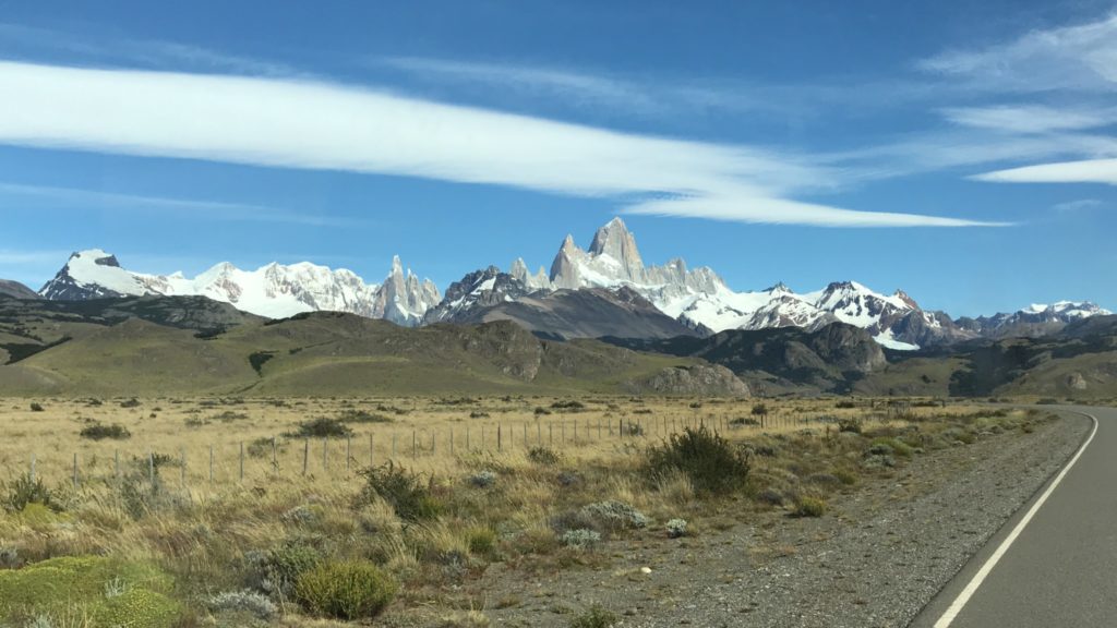
Fly from Buenos Aires to El Calafate, a 3.5 hours flight, and a 3 hours drive to El Chaltén.

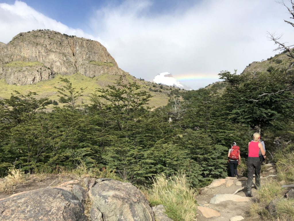
Day 2 Cerro Torre Trek

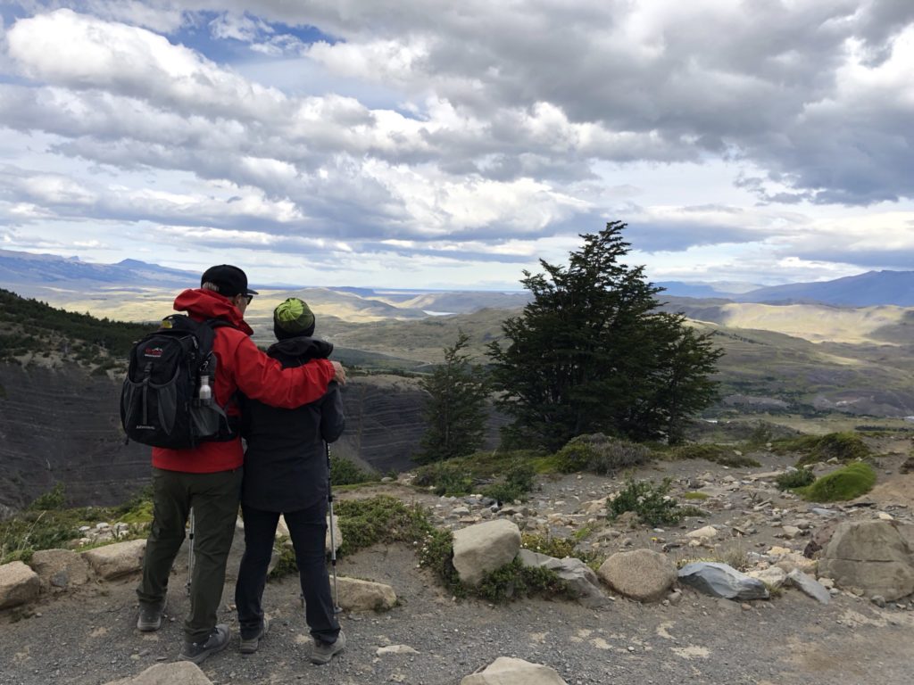
Full day hike to Laguna Torres. This hike ends at Laguna Torres with Glaciar Torre and view of Cerro Torre which we didn’t see as it was shrouded in the low clouds.

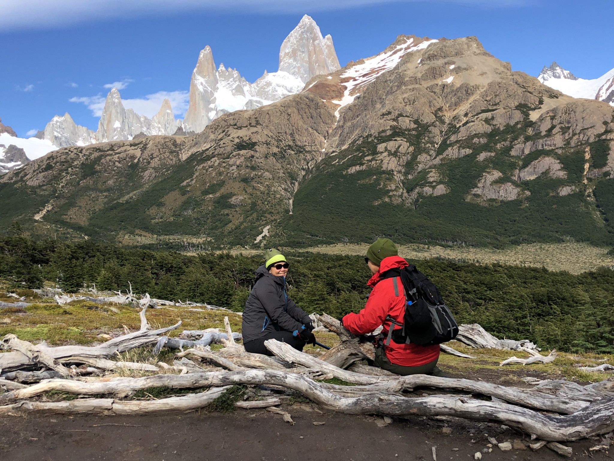
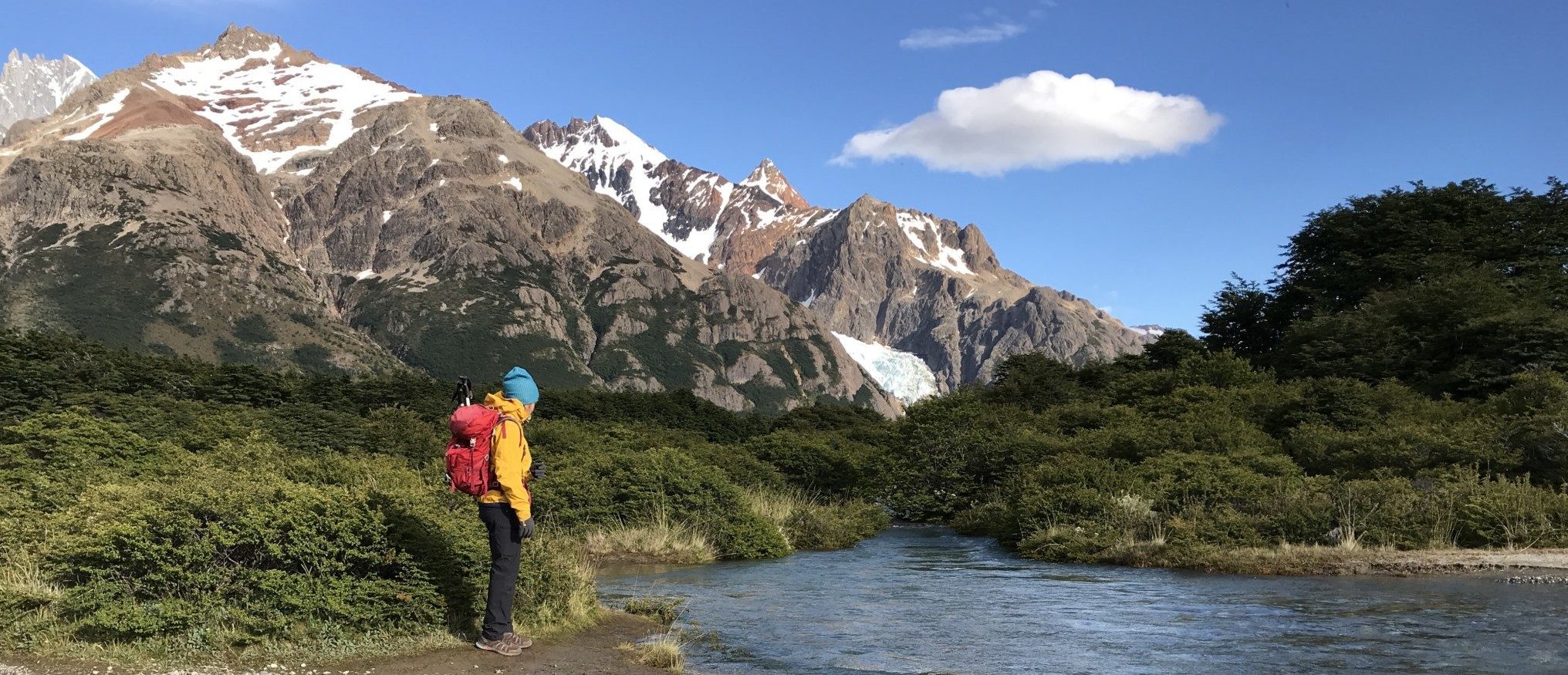
Day 3 Monte Fitz Roy Trek

Let me share with you what we actually did and what I recommend you do instead.

Hired a car to take us to the starting point, El Pillar, 17Km north of El Chaltén. We started at 3am, hiked two hours to Point Poincenot to catch sunrise on Mt Fitz Roy. Instead of hiking up to Laguna de Los Tres at the base of Monte Fitz Roy, we took the easy flat trail to Lago Madre e Hijo then turned back. http://www.tanyeeming.com/the-best-day-hike-in-el-chalten/

In hindsight, I would do the following instead. Start from El Pillar to Campo Poincenot then go all the way to Laguna de Los Tres. On the way back, at Poincenot, take a different route and walk all the way downhill back to El Chalten town.

Tips at El Chaltén

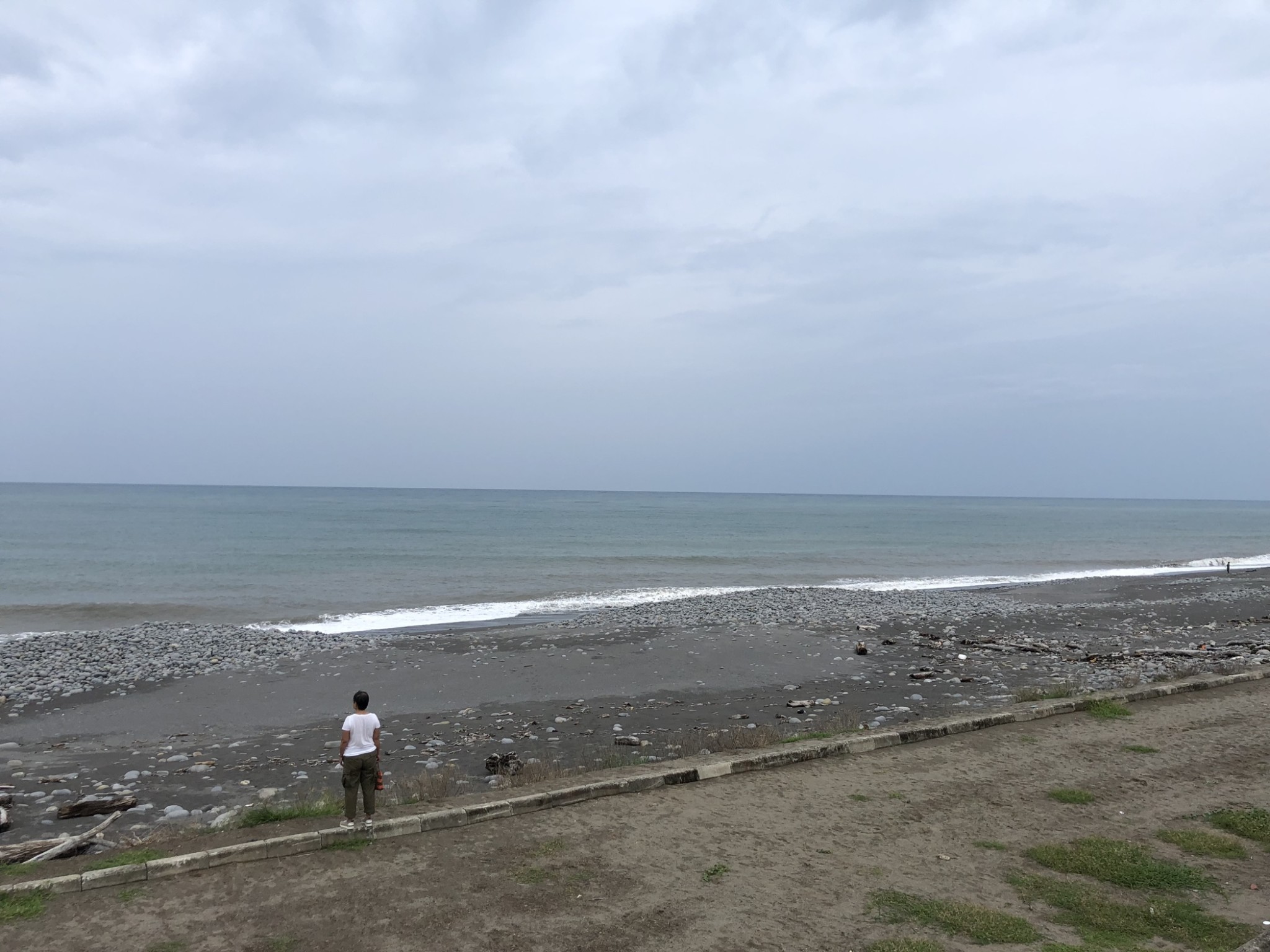
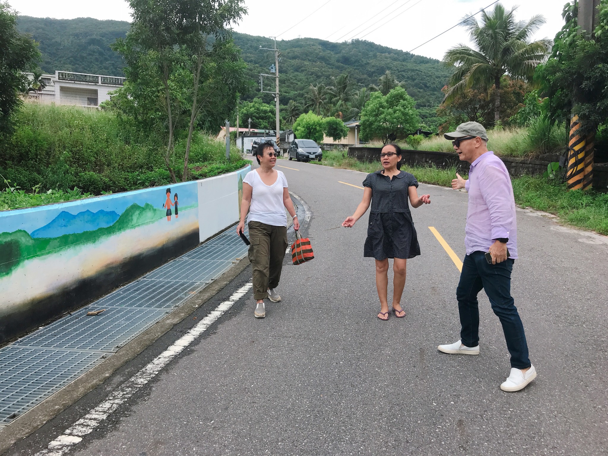
1. The sun doesn’t set until around 9.30 or 10pm. You can still go out and explore El Chaltén after a full day hike. If the weather is good, make sure you go outdoor, walk to the river Rio Fitz Roy (entry to the town) and you get panoramic view of the mountain range with El Chaltén town in the foreground.

2. The best restaurant here is La Tapera. Their Locro, a Argentinian hearty stew and vegetable rice wok, a very wet fried rice with vegetable is surprisingly good.

3. Internet is very slow and no cellular signals.

4. We stayed at the top hotel Los Cerros which is so so and it is at the highest point in town. I would just be happy to stay in the cheaper places below and get a better view of Fitz Roy instead.
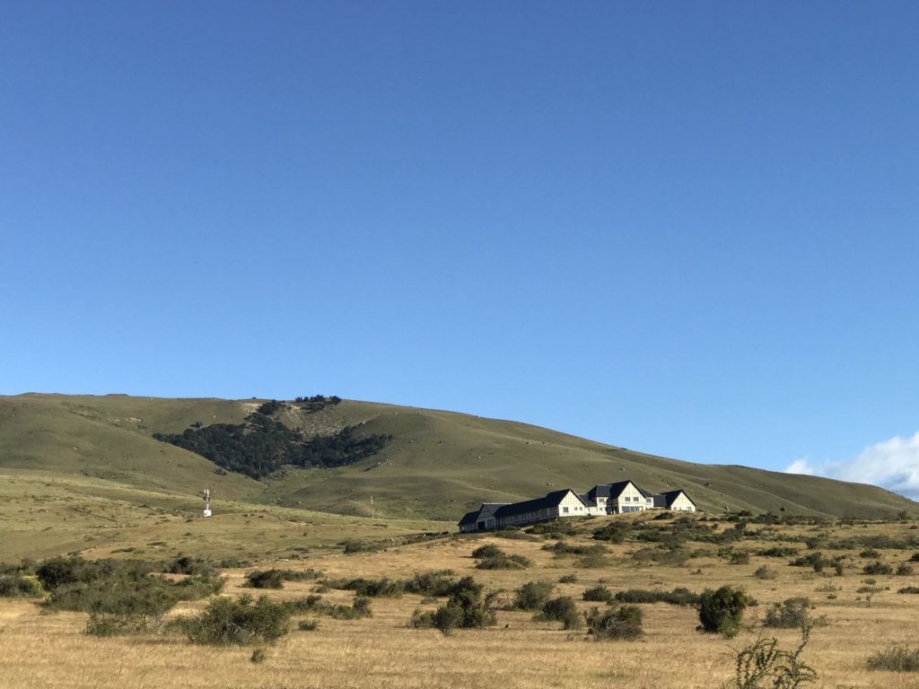
Day 4

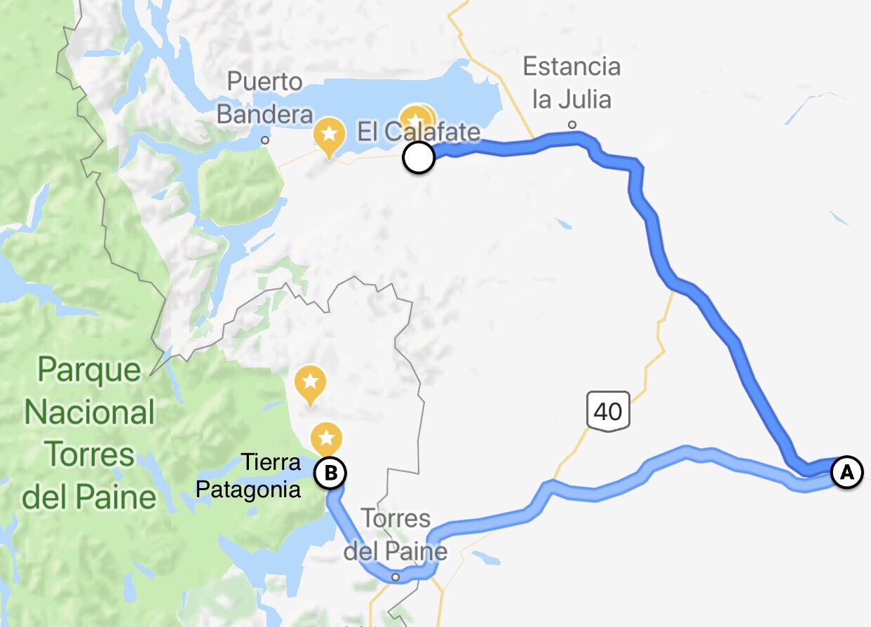
Transfer from El Chaltén to El Calafate and from there 30 mins drive to our next hotel Eolo Patagonia. Gorgeous little hotel in Estancia Alice with views of Lago Argentina on the north and Torres del Paine mountain range on the south.
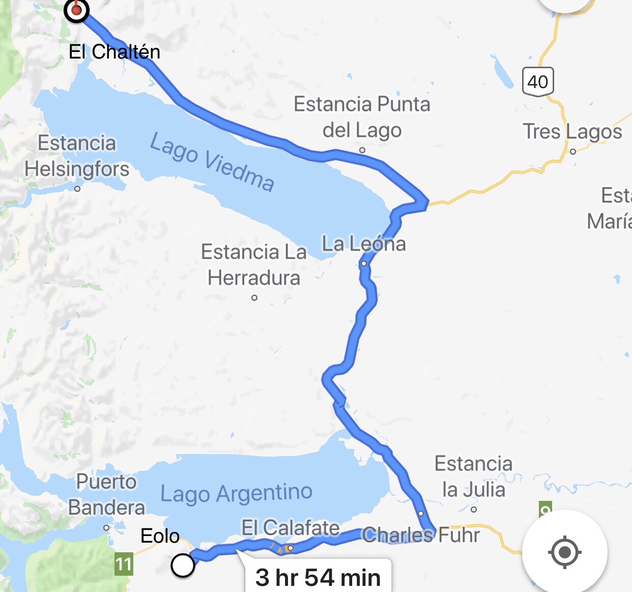
Day 5
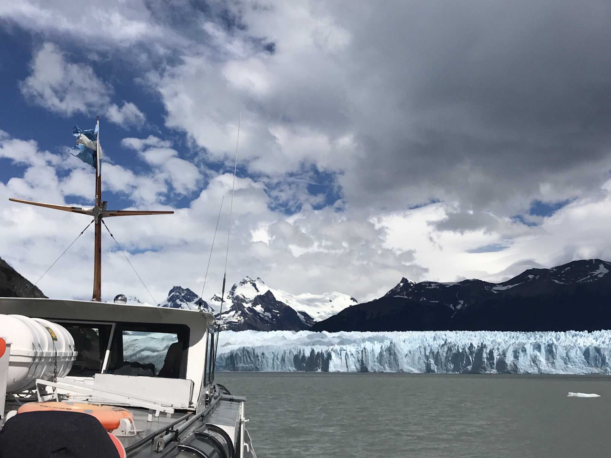
Glaciar hiking at Perito Moreno, a full day excursion.

Day 6

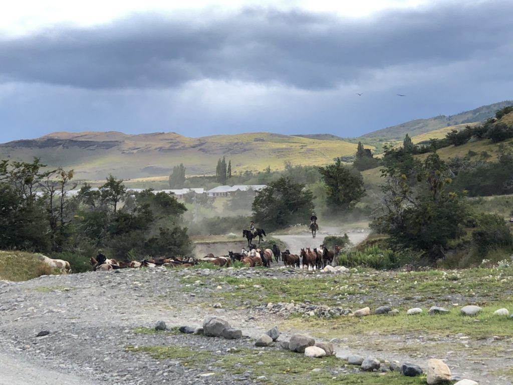
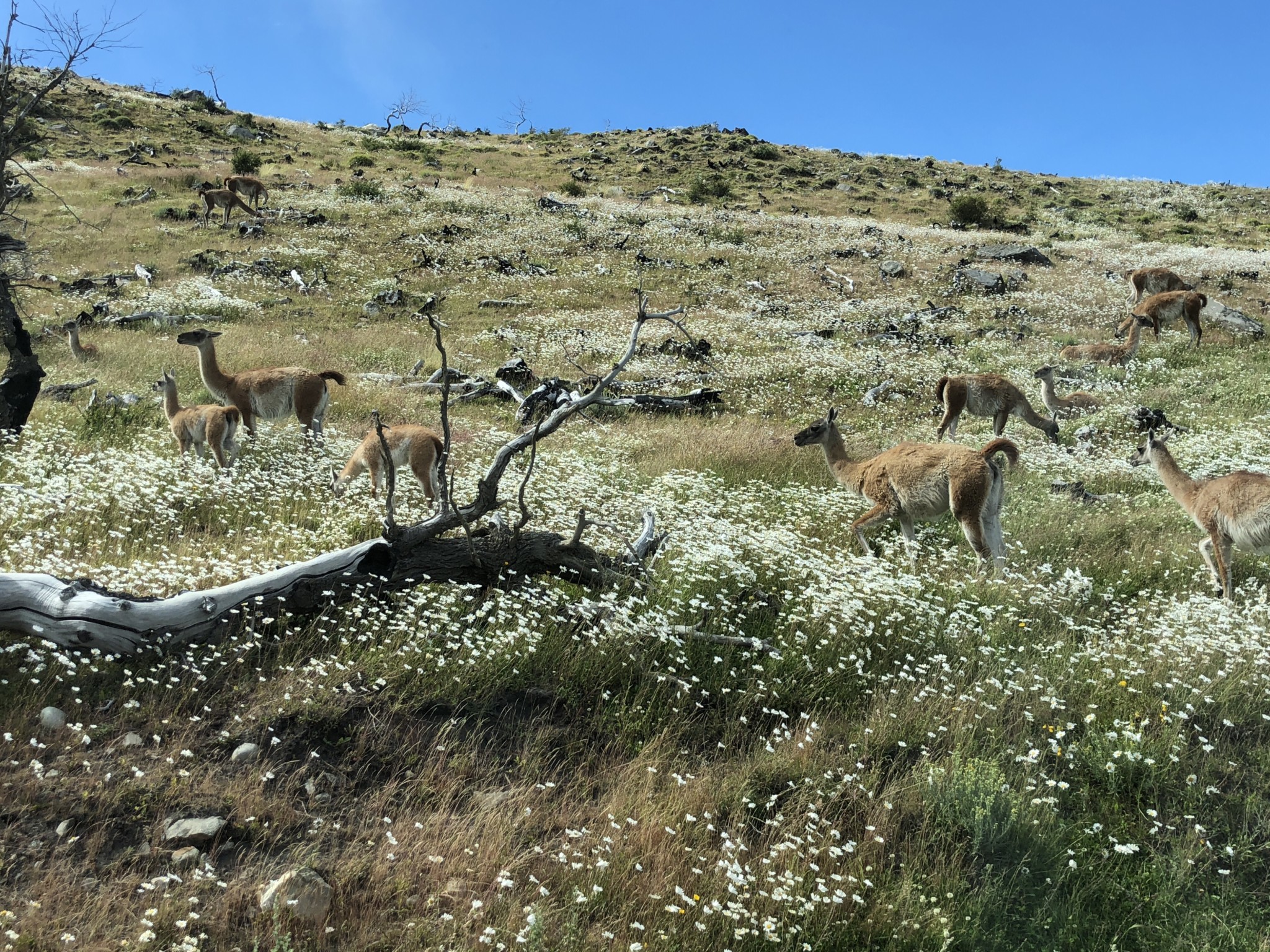
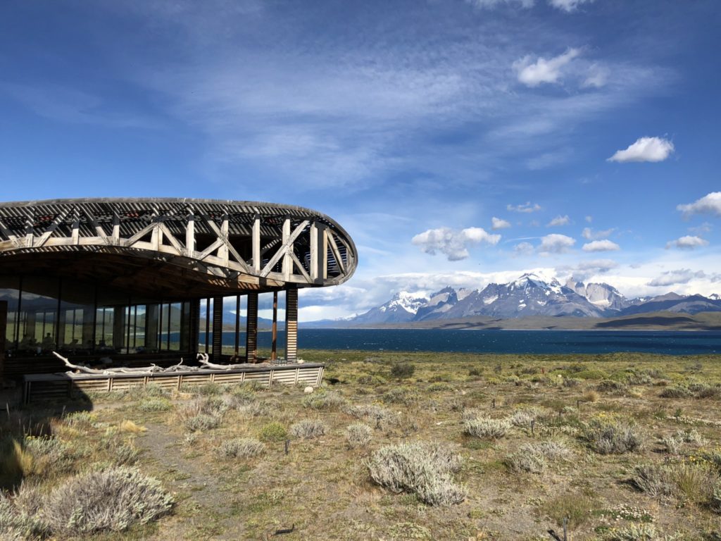
On the road. Travel by car from El Calafate on Ruta 40, stopped at La Esperanza, crossed the Argentina and Chilean border to arrive at our next hotel Tierra Patagonia. Beautiful five hour drive across Patagonian steppe. We arrived at Tierra in time for lunch and joined the afternoon excursion to Laguna Azul. Saw plenty of wildlife and waterfall on the drive to the lake. A stroll on the shore of Laguna Azul ending with a nice picnic while admiring the view.

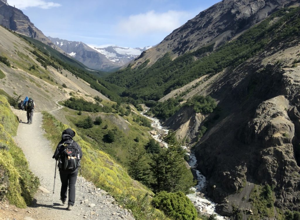
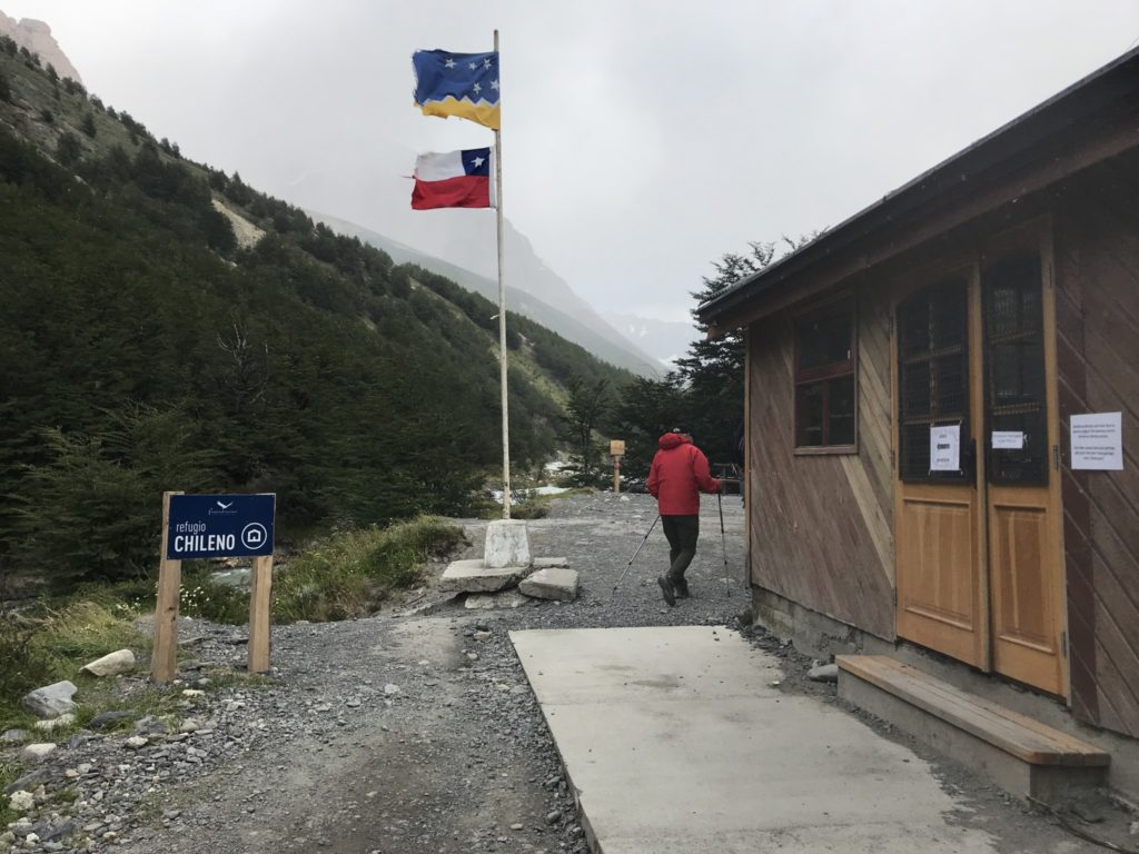
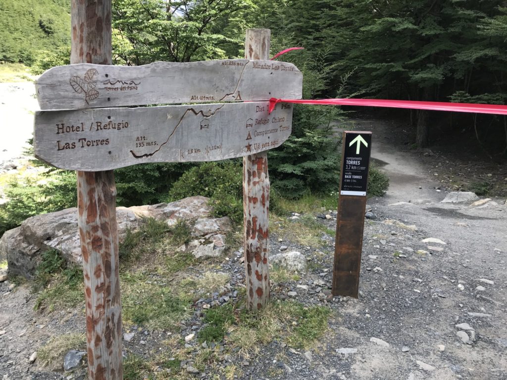
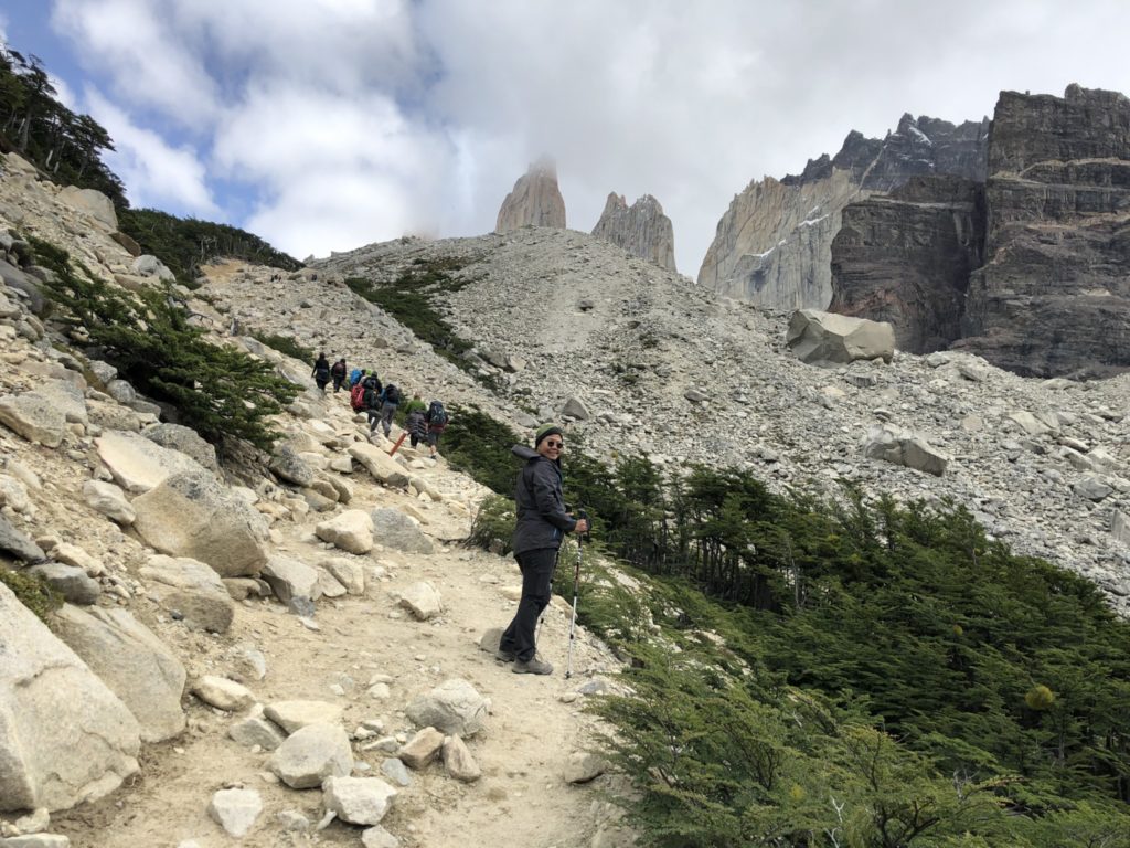
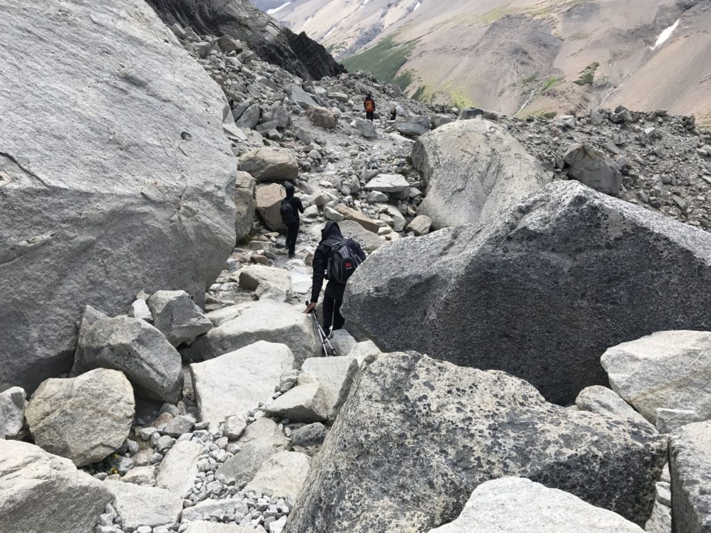
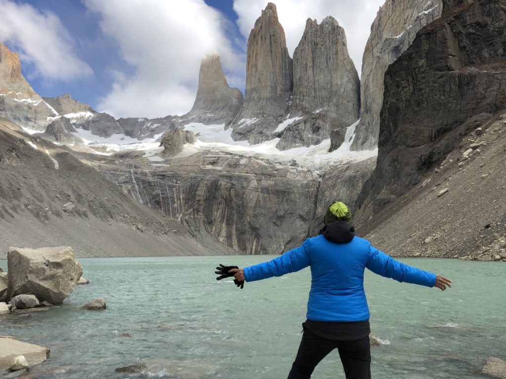
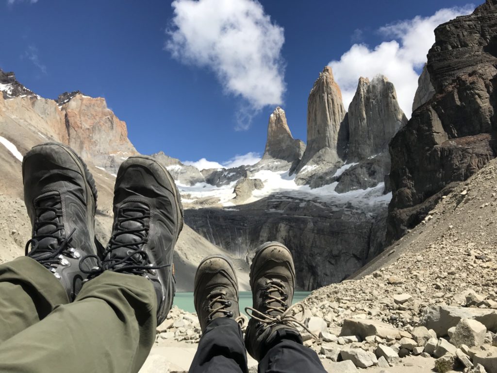
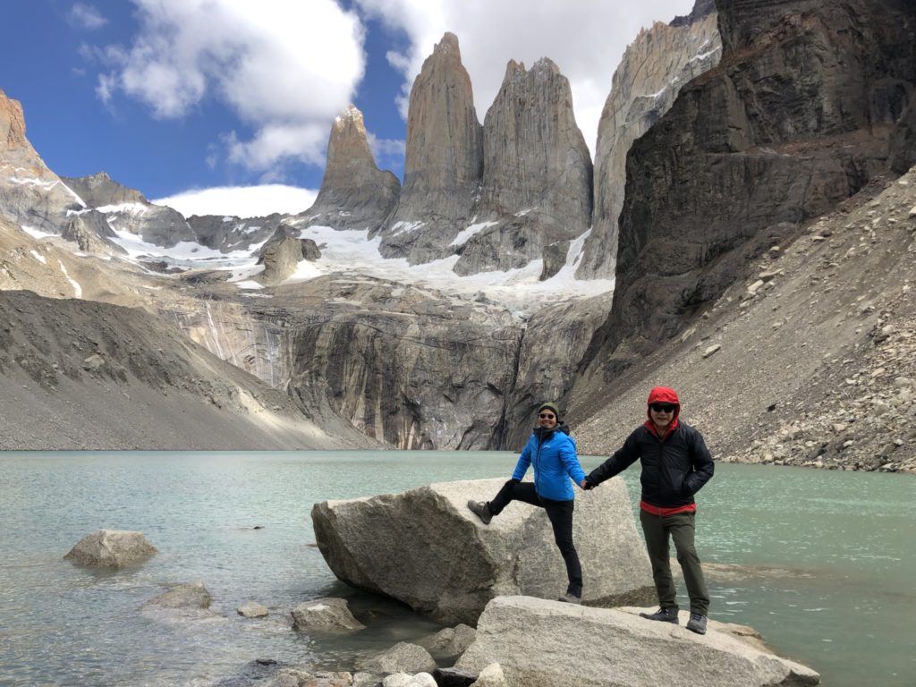
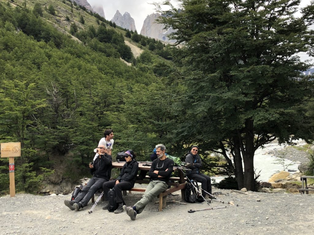
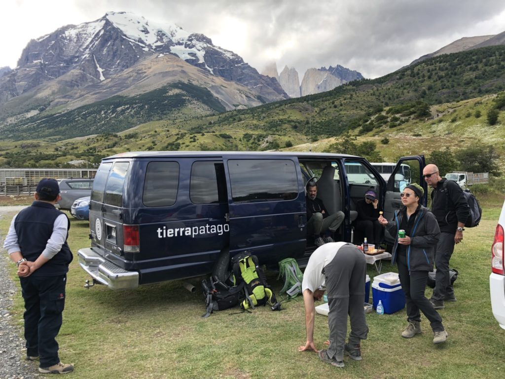
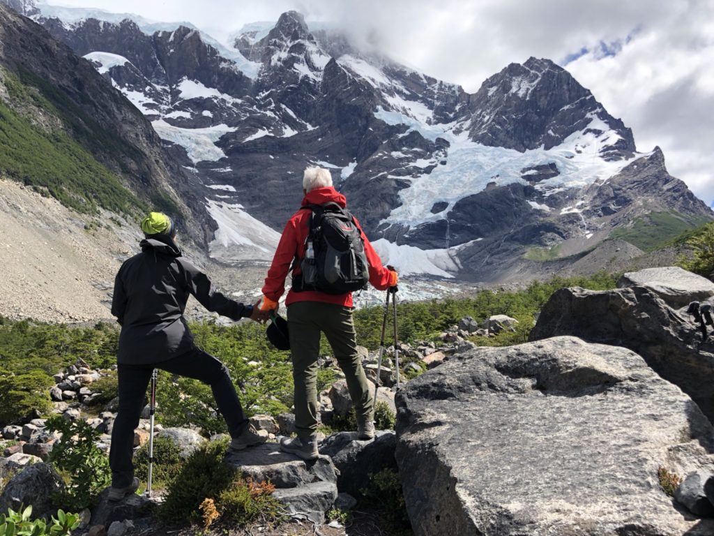
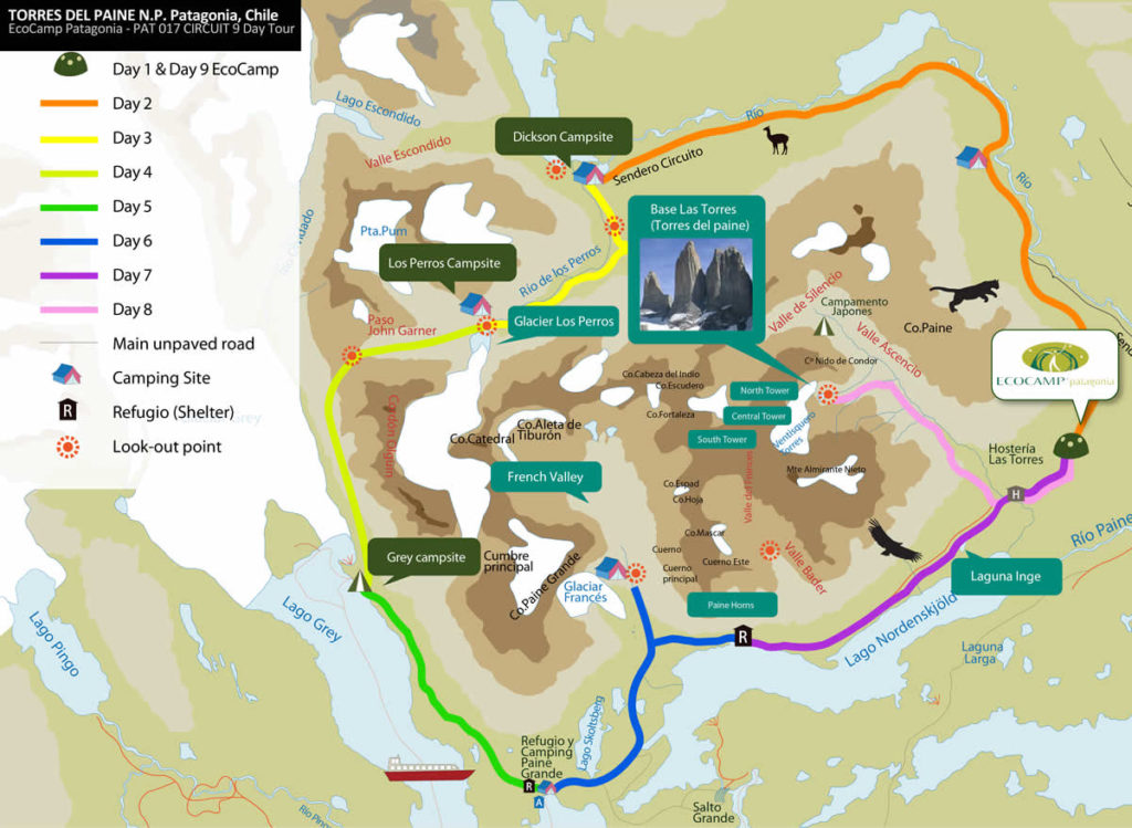
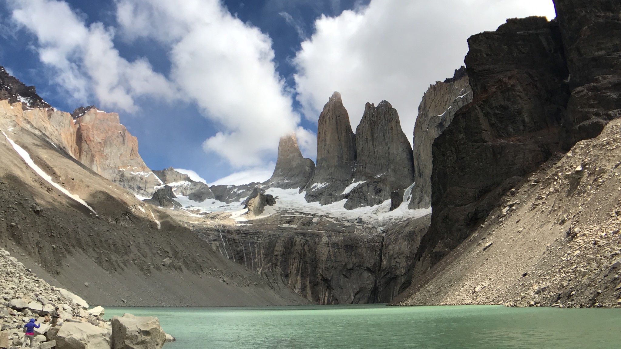
Day 7 Paine Tower full day hike 

Read here for details of the hike and pictures. http://www.tanyeeming.com/the-best-day-hike-in-torres-del-paine/

Day 8

Enjoy the day at the hotel. Woke up early to catch the sunrise on Torres del Paine mountain range, enjoy a leisurely breakfast, catch up with emails and reading, hang out with new friends, explore Lake Sarmiento right in front of the hotel and surrounding. A glorious day indeed.

Day 9 French Valley full day hike

A long day. A 45 minutes drive, then an hour or so on the boat and we finally got to Refugio Paine Grande to start the French Valley trail ( the middle leg of W).

Day 10

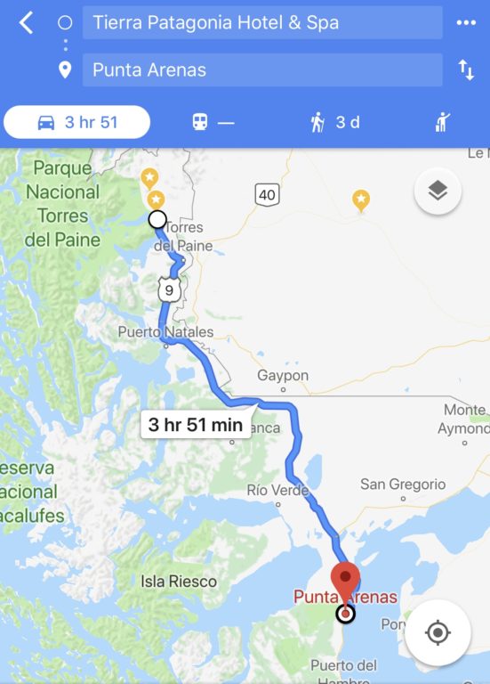
Depart hotel for Punta Arenas airport, which is 4 hours drive away.

if I were to do this trip again, I would do either of these two things.

1. Spend one full day or stay one night in Punta Arenas. There are several amazing hotels here and visit the penguin colonies here at Isla Magdalena (half day tour).

2. If I have more time, I would tour Antarctica. There is a an 11-day Antarctic fly and sail cruise adventure from Punta Arenas to Ushuaia. Or fly to Ushuaia then go to Antarctic from there as more cruises leave from Ushuaia.

From Ushuaia which is in Argentina, fly back to Buenos Aires. This will make the international airfare much cheaper as you would fly in and out of Buenos Aires.

The best day hike in Torres del Paine

The W Trek is Patagonia’s most famous hiking route, with the granite towers that give the park its name. In full, it’s a 4 or 5 day hike that can be walked without carrying gear or food, between refugios or campsites. It can also be broken up into day hikes from comfortable hotel bases, or incorporated into longer, wilder treks. To make the four-day trip accessible to all hikers, serviced campsites along the route hire out tents and on-site canteens provide nutritious, three-course meals.

The O or Full Circuit is a 7-9 day route that adds a northern section on to the park’s famous W Trek.  Circling the Paine Massif (the towers) and exploring much more of the national park, this 129 km route, delivers on all of the park’s most celebrated sights. The extra distance and absence of refugios on the northern side, meaning you’ll definitely be doing some camping, make it a tougher trail, as you will be carrying your own camping equipment.

Remember, well-meaning guides will talk you into taking the easier hikes, unless you come prepared knowing specifically what you want to do. This time we insisted that we are ready for the challenge. 

We knew we wanted to walk to the base of the towers(the pink route on the map), about 20km and 9 hours to complete. It is the toughest of all day hikes but is also the iconic trail in Torres del Paine National Park. With its landscape of aquamarine glacial lakes, and the skyrocketing granite torres (towers) from which the park takes its name, Torres del Paine has captured the imagination of trekkers from all around the world.

The walk started easily enough with a flat stroll across the open grassland from the Eco Camp,  then we began to hike up a steep ascent next to the Ascencio River until reaching the Paso de los Vientos (Pass of the Winds).

After passing through dense forests at Refugio Chileno, we reached the most challenging point of the trail. This last section, a 1.5km moraine section of loose rock and boulders and 500m elevation,  requires total focus and often using our hands as well.  

Having ascended through this difficult terrain and battled against the winds we arrived at the lookout where we were face to face with the classic, breath-taking view of the Torres del Paine. What the pictures cannot show is the biting Patagonian winds of Torres del Paine, so strong that it will knock you off your feet. We all settled down to our well deserved packed lunch. Our guide Thomas whipped out from his heavy backpack tea bags and hot water for a nice cup of tea. Just what i needed after the long hike.

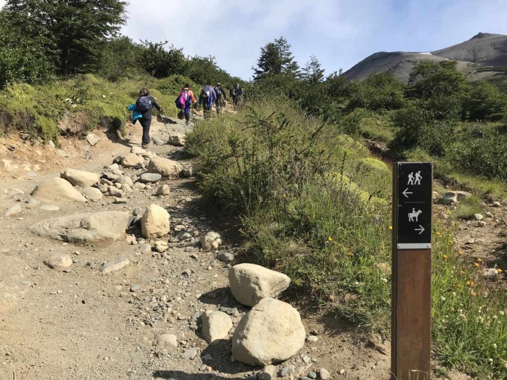
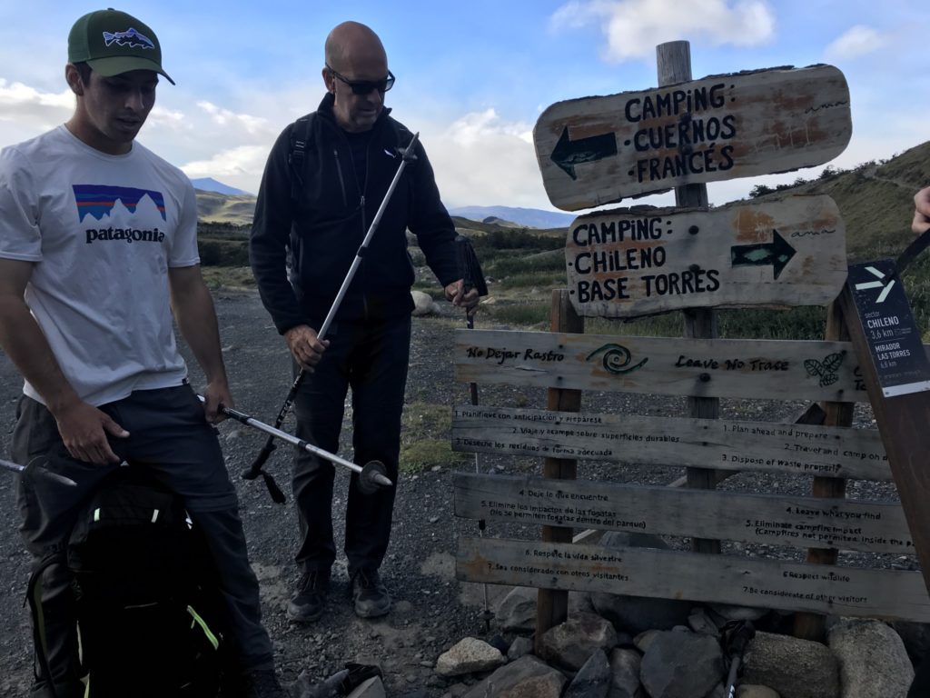
Trail head, near Hosteria Los Torres[/caption]

The last section, approximately 1.5km and 500m elevation,  is the toughest part, a strenuous scramble over the moraine, often using our hands to climb the huge boulders. 

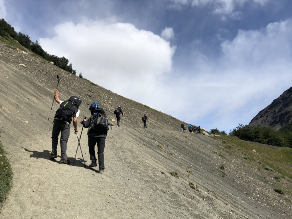
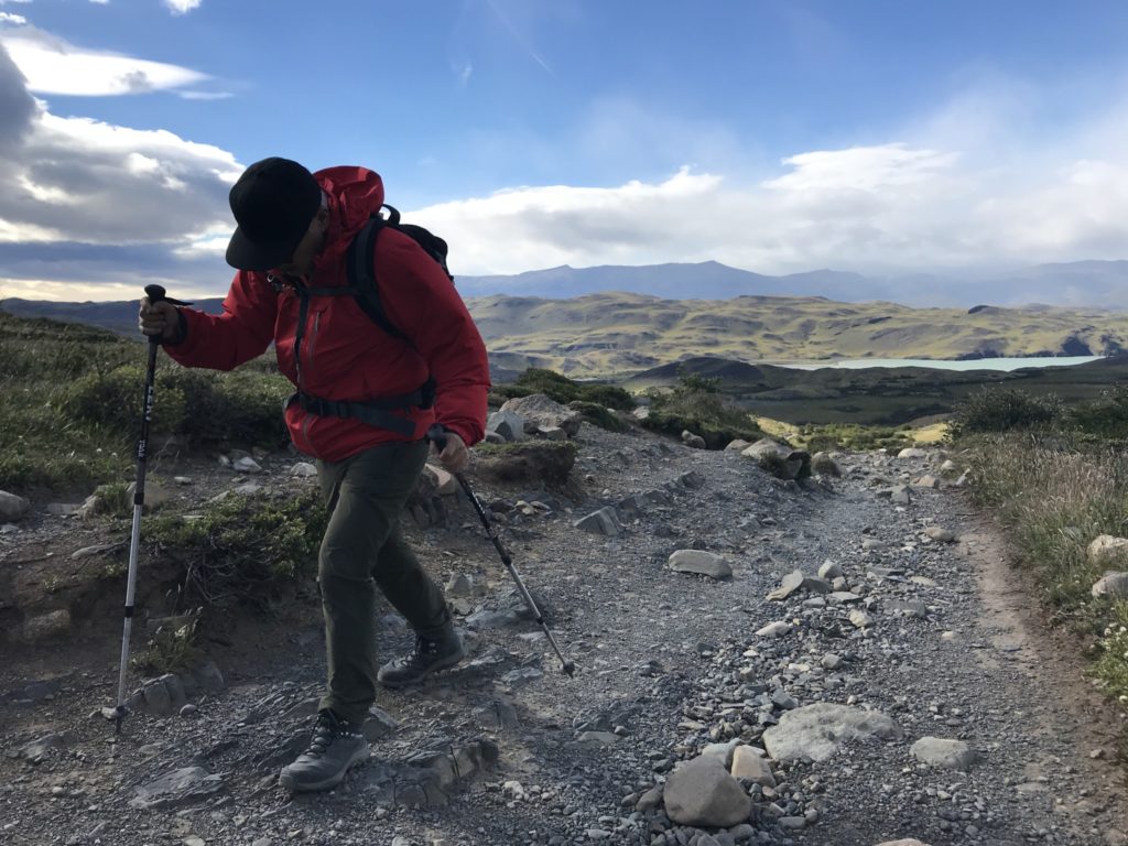
A steep climb up the valley[/caption]

Taking a breather

This stretch is a wind tunnel. At one point, a gust of Patagonian wind literally stopped me in my tracks. If it wasn’t for the backpack, I would have been blown over.
Didn’t know what moraine is until I got here. Moraines are accumulations of dirt and rocks that have fallen onto the glacier surface or have been pushed along by the glacier as it moves. The dirt and rocks composing moraines can range in size from powdery silt to large rocks and boulders.
Refugio Chileno camp site, and others in the Park, are serviced camp site. Tents and meals are provided, saving trekkers the hassles of carrying own camping equipment.

When we got to Refugio Chileno, we were told Las Torres Lookout was close due to strong winds. I flew half way around the world for this and it was so disappointing. We were so close already! As luck would have it, the trail miraculously reopened just as we were about to turn back.

Here is another section of moraine, this time with bigger rocks and boulders.
The most grueling part of the trail, about 1.5 hours of navigating through rocks and boulders.
Euphoric moment of blue sky, warm sun and chilling Patagonian wind.
We made it!

Downhill is just as tough as the climb, really tough on the knees.
Hundreds of horses galloping across the creek.
Celebrating a hard day’s work in style, courtesy of Tierra Patagonia. Cold beer, cold cut and fruits!